
Jump to a section2 sections in this guide+
Open the shipwreck map full screen →
Plan a treasure dive
Start with Kenton’s underwater treasure guide for equipment and collection progress. Each wreck on the map includes its finds and an in-game map showing the dive site. For other sets, visit the GTA VI collectibles guide.
WAiNK landmark scans
Choose WAiNK Landmarks in the map filters. Open a pin to see which object to frame, then use the location map to line up your approach. On PlayStation, hold Up to open WAiNK and press R1 to scan. Your journal records the result under Progress → Collections → WAiNK Locations → Landmarks.
WAiNK Curiosities in GTA VI
Track 35 scan locations across Leonida. Open a pin for its target, then mark it as found. On Dalton Island, descend the stairs beside the golden sculpture and scan the Big Entrance lettering. In Key Lento, look for the Christmas lights on Pacific Drive. At Southwind, look among the trees for the Fingerpost sign.
Explore WAiNK Curiosities on the full-screen map →
Check your in-game list under Progress → Collections → WAiNK Locations → Curiosities.
WAiNK Sculptures in GTA VI
Find all 23 sculpture locations in Leonida. In Washington Beach, look beneath the bridge for Neptune Rises or outside the Vice Museum of Art for the stack of colorful faces. Open a pin to identify the piece and mark your scan. Found pins fade to 25% opacity.
No Flusher Tags on Shore Drive
Two ground markings lie along Shore Drive in Ocean Beach. At The Buckingham, cross the street and check the sidewalk beside the planting bed. At The Banana Hole, look next to the round logo on the pavement. Open either pin for a photo of the paint and a close-up street map.
Collectible card locations in GTA VI
Explore 149 pickup locations across 18 card sets, including all 90 cards in the three Dancers sets. Choose a set or search by name or neighborhood, then open the pin for a photograph of the hiding place and a close-up location map. In Key Lento, look for Marquise Bernard on the barrel outside Kenton’s shop. In Port Gellhorn, check the Starlet Motel kitchen refrigerator for Victor Maravilla before Chapter 2 ends.
Messages in a Bottle
Explore six shoreline pickups around Key Lento. Each pin shows the beach debris or vegetation to look for, a pickup photo and a close-up map. Mark each bottle as found to keep track as you move along the coast.
Printable map of Leonida
Rockstar’s illustrated state map shows the roads, coastline and county boundaries in one sheet. Use it to plan a route on paper, then use the interactive layers above to check off individual finds.
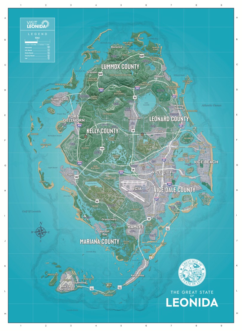
Download the print map (ZIP, 43 MB)
Extract the JPG, choose portrait orientation and select “Fit to page” to keep the legend and outer grid on the sheet.
Collectibles and stunts around Leonida
Choose a layer to plan your route. Open a meditation spot or flamingo to compare the view on the ground with the in-game map. Mark each stop as found to keep track on this device.
Field guides for exploring Leonida
How to read the collectible counters
The card layer counts marked pickup locations. Compare the name and edition with the cards in your collection before marking a pickup. The completion target counts finished sets. The flamingo layer shows mapped finds; the game tracks 125 figures, of which 100 count toward the completion target.
Where to look for the four Pee-Wee billboards
Use the highway numbers to narrow down each search. From the roadside, face the advertising panel itself and open WAiNK to scan it.
- Vice-Dale: Head to western Balsero. Look above the entrance ramp for US-10.
- Mariana County: Take US-82 between North Mariana County and Grassrivers. Look toward the median between the carriageways.
- Lummox County: Follow US-628 to the boundary between southwestern Lummox County and Mount Kalaga National Park. Check the sign above the highway.
- Leonard County: In northwestern Waning Sands, follow SR-27 alongside the railway. Search the strip between the road and the tracks.
Belville meteorite and collectible card
Two finds share a garage on the north side of Belville town center. Search beneath the bed for a meteorite fragment, then turn to the board on the right wall for the purple Illuminaughty card from The Legends of Ratface. Use the garage map to pick the right house in the row.
Seven meteorite fragments around Key Lento
Three nearby stops look similar on the map. Use the photo to distinguish the dead tree at the waterline, the gap in the shoreline rocks and the forked tree. The tidal pool, camp, derelict spy vessel and inlet carcass each have a separate pin. Tap a pin to see its hiding place, then mark it as found before moving on.
Watson Bay beach meteorite
Look for the half-sunken boat offshore. Walk around the overturned wooden dinghy on the beach and check the sand along its lower edge.